Boundary disputes are among the most common — and most stressful — property disagreements in England. A few centimetres can become the source of years of conflict and thousands of pounds in legal fees. The good news is that a professional boundary survey can often resolve the matter quickly, fairly and far more cheaply than going to court. In this guide, our chartered surveyor James Hartley MRICS explains everything you need to know about boundary disputes and how a qualified surveyor can help.
Why Do Boundary Disputes Happen?
Land Registry title plans are drawn at a small scale (typically 1:1250) and are explicitly not intended to precisely define property boundaries. The Land Registry itself states clearly that title plans show only the general position of boundaries — not the exact legal line. This ambiguity, combined with fences that have moved over time, development encroachments, unclear historic title deeds and changes in ownership over many decades, creates fertile ground for disputes between neighbours.
In East Sussex, where many properties have complex ownership histories and boundary features such as ancient hedgerows, dry stone walls and ditches that may have shifted or been modified over centuries, establishing the legal boundary can be a genuinely complex exercise requiring specialist knowledge.
Common triggers for boundary disputes include:
- A neighbour replacing a fence in what you believe is the wrong position
- A new extension being built that appears to encroach onto your land
- Planning applications that prompt a neighbour to investigate boundary positions for the first time
- Change of ownership — a new neighbour who challenges the existing state of affairs
- Land value increases (particularly in areas like Crowborough and Tunbridge Wells) making previously ignored boundary discrepancies worth pursuing
What Does a Boundary Survey Involve?
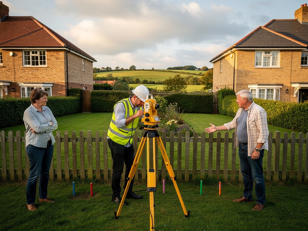
Our chartered surveyors carry out detailed boundary surveys that combine physical measurement with desk-based research. A thorough boundary survey includes:
- Physical site measurement — using precision survey equipment (total station or GPS survey instruments) to measure the actual positions of boundary features including walls, fences, hedges, ditches and buildings
- Review of title deeds and conveyancing plans — examining the original conveyance documents, transfer plans and any boundary agreements registered with the Land Registry
- Analysis of Land Registry records — including the title plan, any registered boundary agreements, and any notes about boundary positions in the title register
- Historical Ordnance Survey maps — OS maps from different eras can show how boundary features have changed over time and help identify the original intended boundary position
- Examination of physical boundary features — walls, fences, hedges, ditches, banks and other features are assessed for their age, condition and likely original position
- Preparation of a scaled boundary plan — showing the measured positions of all boundary features relative to the title plan, clearly identifying any discrepancies
- A written report — setting out the surveyor's findings, interpretation of the evidence, and conclusions about the probable legal boundary position
Understanding the General Boundary Rule
English land law operates on the 'general boundary rule', which means that the Land Registry title plan shows only the general position of a boundary — not its precise legal location. The exact position of the legal boundary is determined by examining the full title documentation, including the original conveyance or transfer documents, any plans attached to those documents, and any expressions of intention in the wording of the deeds.
This is why a boundary dispute cannot be resolved simply by looking at the Land Registry plan. It requires a qualified surveyor who understands both the legal framework and the physical evidence on the ground. Many boundary disputes that appear complex are actually resolvable with careful analysis of the available documentary and physical evidence.
The Role of an Expert Witness Surveyor
If a boundary dispute cannot be resolved by agreement between the parties, it may proceed to the First-tier Tribunal (Property Chamber) or, in more complex cases, the courts. In these situations, an independent expert witness surveyor provides an impartial, objective opinion based on the physical and documentary evidence — not on either party's preferred outcome.
Expert witness reports in boundary disputes must comply with Civil Procedure Rules (CPR) Part 35, which governs the duties and obligations of expert witnesses in civil proceedings. The overriding duty of an expert witness is to the court — not to the party who instructed them. Our surveyors have experience preparing CPR-compliant expert witness reports and giving oral evidence in tribunal and court proceedings.
Learn more about our Expert Witness services.
Common Types of Boundary Dispute in East Sussex
In our experience serving Crowborough, Heathfield, Uckfield and the wider East Sussex area, the most common boundary disputes involve:
- Fence positioning — a neighbour's new fence erected over or beyond the boundary line, often by just a few centimetres but sometimes by a more significant amount
- Extension encroachment — a new extension or outbuilding built partially on a neighbouring property, sometimes discovered only when the neighbour applies for planning permission or remortgages
- Right of way disputes — blocked or disputed access over a shared path, driveway, alleyway or passageway
- Garden grabbing — disputed ownership of a strip of land, typically a few metres wide, along a boundary
- Adverse possession — a neighbour claiming ownership of land through long, open, unchallenged use (typically 10–12 years for registered land)
- Hedge and tree root encroachment — a neighbour's hedge or trees growing over or under the boundary
- Historic ditch and bank boundaries — particularly common in rural East Sussex where ancient field boundaries may have been partially infilled or altered
Adverse Possession: A Special Case
Adverse possession — sometimes known as 'squatter's rights' — allows someone to acquire legal ownership of land they have occupied openly and without the owner's permission for a sufficient period of time. For registered land (the vast majority of land in England and Wales today), the threshold is generally 10 years of adverse possession, after which the possessor can apply to be registered as owner. The registered owner then has the opportunity to object.
Adverse possession cases require careful assessment of the history of occupation, the physical state of the boundary features, and the relevant legal tests. They are increasingly litigated as land values rise and the stakes become higher. If you believe a neighbour is claiming adverse possession of your land — or if you wish to regularise your own occupation of a strip of land — we recommend seeking legal advice promptly and commissioning a professional boundary survey to establish the factual position.
How to Resolve a Boundary Dispute: Step by Step
Our recommended approach to resolving a boundary dispute is:
- Commission a professional boundary survey — establish the facts objectively before entering into any discussion with your neighbour. It is far easier to negotiate from a position of clear, independent evidence than from assertion and counter-assertion.
- Seek legal advice — a solicitor specialising in property law should review your title documents and the survey report before you make any formal approach to your neighbour.
- Attempt to negotiate directly — many disputes can be resolved by calm, evidence-based discussion between neighbours, particularly when both parties have access to independent professional findings.
- Consider formal mediation — a trained mediator can help both parties work towards a mutually acceptable solution without the cost and stress of legal proceedings. Many boundary disputes that appear intractable are resolved through mediation in a single day.
- Party wall or boundary agreement — formalising the agreed boundary position through a deed of determination or boundary agreement, registered with the Land Registry, provides certainty for both parties and future owners.
- Tribunal or court proceedings — as a last resort only. The First-tier Tribunal (Property Chamber) has jurisdiction over most boundary disputes and is generally less expensive and more accessible than the courts, but proceedings still take time and money.
Early professional involvement almost always saves money in the long run. Court proceedings in boundary disputes can easily cost both sides tens of thousands of pounds each and take 18 months or more to resolve — at which point the relationship with your neighbour is typically irreparably damaged.
Boundary Surveys vs. Land Registry Determined Boundaries
The Land Registry offers a formal process for registering a 'determined boundary' — an exact boundary position agreed between neighbours or established by the courts or tribunal. Once registered, a determined boundary is conclusive and binding on all future owners. This provides the highest level of certainty and is particularly valuable where the boundary is the subject of ongoing or likely future disputes.
Our surveyors can prepare the required boundary survey plan to the Land Registry's specification as part of a determined boundary application. This is often done in conjunction with a solicitor handling the legal aspects of the application.
What Does a Boundary Survey Cost?
Boundary survey fees depend on the complexity of the case, the nature of the available evidence, and whether expert witness services are required. As a guide:
- Standard residential boundary survey with report: £800–£2,000
- Complex rural or commercial boundary survey: £2,000–£5,000+
- Expert witness report (CPR Part 35 compliant): £1,500–£4,000
- Attendance at tribunal or court as expert witness: £1,500–£3,000 per day
These are indicative figures only. Contact us with details of your situation for a tailored fee estimate.